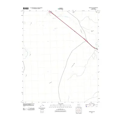
2010 Map of Grants SE
USGS Topo · Published 2010About this map
Rancho del Padre Spring and Horace Springs anchor this arid New Mexico landscape, providing vital water sources in a region defined by high desert mesas and basalt-strewn plateaus. The topography is shaped by the presence of Horace Mesa and the prominent Las Ventanas Ridge, which rises above the ephemeral channel of the Rio San Jose. To the north, the Horace and Quemazon Deposit indicates the geological and mineral potential of the area, while names like Bajar Quemazon and El Cañoncito reflect the cultural heritage of Cibola County. Local transportation is centered on the diagonal route of County Road A-17, which cuts through the sandy stretches of El Medano. This document serves as a high-resolution look at the drainage patterns and landforms, including the seasonal catchment at Laguna del Chical, during the early 21st century.
Find a feature on this map
12 named features on this map. Tap any name to fly to it.
Don’t see what you’re looking for? This feature index may not catch every label — zoom into the map to look around manually.
Map Details
Editions of this 2010 Grants SE Map
This is the sole edition of this map. No revisions or reprints were ever made.
Other maps of this area

1883 · Mt. Taylor
USGS Topo · 1:250,000

1886 · Mt. Taylor
USGS Topo · 1:250,000

1892 · Mt. Taylor
USGS Topo · 1:250,000

1899 · Mt. Taylor
USGS Topo · 1:250,000

1917 · Broom Mountain
USGS Topo · 1:125,000

1954 · Socorro
USGS Topo · 1:250,000

1957 · San Rafael
USGS Topo · 1:24,000

1957 · Lobo Springs
USGS Topo · 1:24,000

1957 · Grants SE
USGS Topo · 1:24,000

1957 · Mc Cartys
USGS Topo · 1:24,000