
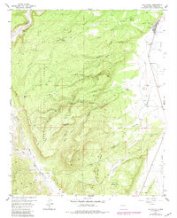
1957 Map of San Rafael
USGS Topo · Published 1959About this map
San Rafael sits at the edge of the high desert and the timbered slopes of the Cibola National Forest, where the lava-etched landscape of the Malpais meets the eastern foothills of the Zuni Mountains. This mid-century survey reveals a network of canyons and springs vital to local life, including Pink Rose Spring and Jose Ignacio Spring which feed into deep drainages like Jose Ignacio Canyon. The settlement pattern follows the valley floor, anchored by the Ojo del Gallo water source and the Porter Cemetery, while the surrounding terrain is defined by prominent basalt features like Gallo Peak and Loma Pelada. The transition from the flatlands of La Vega to the steep timber boundaries is traversed by the historic Agua Fria Trail and early communications lines marked simply as Telephone, illustrating the remote but connected nature of these Valencia County outposts before modern highway expansion.
Find a feature on this map
39 named features on this map. Tap any name to fly to it.
Don’t see what you’re looking for? This feature index may not catch every label — zoom into the map to look around manually.
Map Details
Editions of this 1957 San Rafael Map
2 editions found
Other maps of this area

1883 · Mt. Taylor
USGS Topo · 1:250,000

1886 · Wingate
USGS Topo · 1:250,000

1886 · Mt. Taylor
USGS Topo · 1:250,000

1892 · Wingate
USGS Topo · 1:250,000

1892 · Mt. Taylor
USGS Topo · 1:250,000

1899 · Mt. Taylor
USGS Topo · 1:250,000

1917 · Broom Mountain
USGS Topo · 1:125,000

1951 · Mt Sedgwick
USGS Topo · 1:24,000

1952 · Paxton Springs
USGS Topo · 1:24,000

1954 · Saint Johns
USGS Topo · 1:250,000