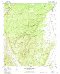
1957 Map of San Rafael
USGS Topo · Published 1981About this map
San Rafael sits at the edge of the sprawling Cibola National Forest, where the high desert terrain transitions into a complex network of volcanic and limestone features. This 1957 survey, with updates through the early 1980s, reveals a landscape defined by seasonal water sources and rugged relief, notably around Gallo Peak and the volcanic depressions of the Vega. The presence of the Porter Cemetery and several isolated springs like Pink Rose Spring and Jose Ignacio Spring suggests the long-standing reliance of local ranchers and settlers on these rare water points.
Find a feature on this map
49 named features on this map. Tap any name to fly to it.
Don’t see what you’re looking for? This feature index may not catch every label — zoom into the map to look around manually.
Map Details
Editions of this 1957 San Rafael Map
2 editions found

Other maps of this area

1883 · Mt. Taylor
USGS Topo · 1:250,000

1886 · Wingate
USGS Topo · 1:250,000

1886 · Mt. Taylor
USGS Topo · 1:250,000

1892 · Wingate
USGS Topo · 1:250,000

1892 · Mt. Taylor
USGS Topo · 1:250,000

1899 · Mt. Taylor
USGS Topo · 1:250,000

1917 · Broom Mountain
USGS Topo · 1:125,000

1951 · Mt Sedgwick
USGS Topo · 1:24,000

1952 · Paxton Springs
USGS Topo · 1:24,000

1954 · Saint Johns
USGS Topo · 1:250,000