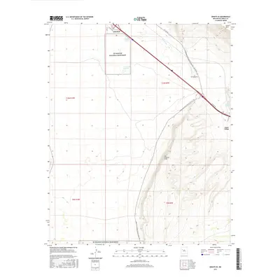
2017 Map of Grants SE
USGS Topo · Published 2017About this map
El Malpais National Monument dominates the western half of this landscape, protecting a stark volcanic environment in New Mexico's high desert. This 2017 study details the eastern periphery of Grants, where the urban edge meets the expansive drainages of the Rio San Jose. The transit corridor is defined by the legacy of Hst Rte 66, which runs parallel to the modern interstate and passes through the small community of El Cañoncito. To the east, the terrain rises sharply toward the heights of Horace Mesa and the prominent Las Ventanas Ridge. The map also captures the path of the Continental Divide National Scenic Trail as it winds through this geologic transition zone, connecting isolated water sources like Rancho del Padre Spring and Horace Springs. Small settlements such as Anzac Village represent the sparse but persistent human footprint in this arid terrain.
Find a feature on this map
19 named features on this map. Tap any name to fly to it.
Don’t see what you’re looking for? This feature index may not catch every label — zoom into the map to look around manually.
Map Details
Editions of this 2017 Grants SE Map
This is the sole edition of this map. No revisions or reprints were ever made.
Other maps of this area

1883 · Mt. Taylor
USGS Topo · 1:250,000

1886 · Mt. Taylor
USGS Topo · 1:250,000

1892 · Mt. Taylor
USGS Topo · 1:250,000

1899 · Mt. Taylor
USGS Topo · 1:250,000

1917 · Broom Mountain
USGS Topo · 1:125,000

1954 · Socorro
USGS Topo · 1:250,000

1957 · San Rafael
USGS Topo · 1:24,000

1957 · Lobo Springs
USGS Topo · 1:24,000

1957 · Grants SE
USGS Topo · 1:24,000

1957 · Mc Cartys
USGS Topo · 1:24,000