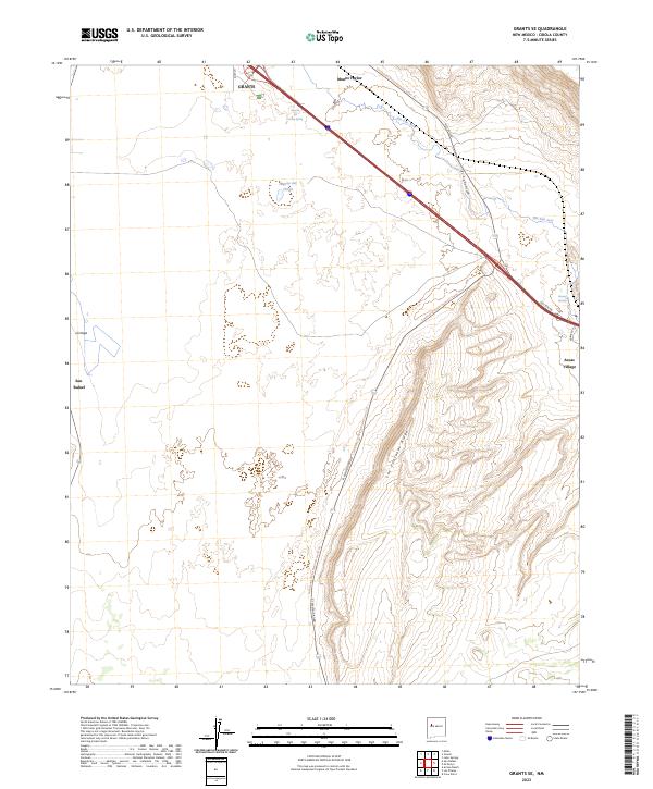
2023 Map of Grants SE
USGS Topo · Published 2023About this map
El Malpais National Monument dominates the southwestern New Mexico landscape, preserving the volcanic terrain and ancient cultural pathways southeast of Grants. This modern survey illustrates the convergence of historic transportation routes and natural barriers, where Hst Rte 66 and Interstate 40 parallel the path of the Rio San Jose. The transition from the high desert floor to the prominent Las Ventanas Ridge defines the eastern portion of the quadrangle, while the long-distance Continental Divide National Scenic Trl winds through the volcanic landscape and along El Malpais Road. Smaller communities and historical markers such as San Rafael, Anzac Village, and the Rancho del Padre Spring offer localized points of interest for those tracing the development of Cibola County’s infrastructure near the base of Mount Taylor.
Find a feature on this map
20 named features on this map. Tap any name to fly to it.
Don’t see what you’re looking for? This feature index may not catch every label — zoom into the map to look around manually.
Map Details
Editions of this 2023 Grants SE Map
This is the sole edition of this map. No revisions or reprints were ever made.
Other maps of this area

1883 · Mt. Taylor
USGS Topo · 1:250,000

1886 · Mt. Taylor
USGS Topo · 1:250,000

1892 · Mt. Taylor
USGS Topo · 1:250,000

1899 · Mt. Taylor
USGS Topo · 1:250,000

1917 · Broom Mountain
USGS Topo · 1:125,000

1954 · Socorro
USGS Topo · 1:250,000

1957 · San Rafael
USGS Topo · 1:24,000

1957 · Lobo Springs
USGS Topo · 1:24,000

1957 · Grants SE
USGS Topo · 1:24,000

1957 · Mc Cartys
USGS Topo · 1:24,000