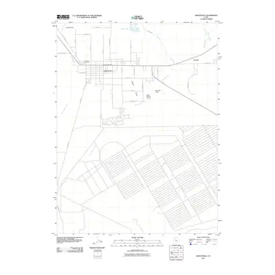
2011 Map of Grantsville
USGS Topo · Published 2011About this map
Grantsville and the surrounding Tooele Valley are shown here during a period of modern expansion within this historic Utah settlement. The map documents the city's structured grid, anchored by the Grantsville Post Office and the Grantsville City Cemetery, while tracking the transition from residential streets to the agricultural and natural features of the Great Salt Lake basin. To the west, the landscape is defined by the drainage of North Willow Creek and South Willow Creek flowing from South Willow Canyon, while the northern reaches transition into the wetlands of Cooleys Slough and Blue Lakes. This survey is particularly useful for tracing early transportation routes, including the legacy of the Old Lincoln Hwy and the path of the Mormon Trl, providing a clear view of how these historic corridors intersect with modern developments like Willow Fields and the outlying community of Marshall.
Find a feature on this map
36 named features on this map. Tap any name to fly to it.
Don’t see what you’re looking for? This feature index may not catch every label — zoom into the map to look around manually.
Map Details
Editions of this 2011 Grantsville Map
This is the sole edition of this map. No revisions or reprints were ever made.
Other maps of this area

1885 · Tooele Valley
USGS Topo · 1:250,000

1918 · Stockton
USGS Topo · 1:62,500

1953 · Tooele
USGS Topo · 1:250,000

1955 · Timpie
USGS Topo · 1:62,500

1955 · Mills Junction
USGS Topo · 1:24,000

1955 · Deseret Peak
USGS Topo · 1:62,500

1955 · Burmester
USGS Topo · 1:24,000

1955 · Grantsville
USGS Topo · 1:24,000

1955 · Stockton
USGS Topo · 1:62,500

1955 · Tooele
USGS Topo · 1:250,000