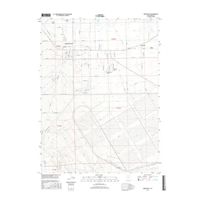
2017 Map of Grantsville
USGS Topo · Published 2017About this map
Grantsville and its surrounding agricultural and desert landscape are captured here in the eastern reaches of the Tooele Valley. The residential core is defined by a traditional grid including W Main St and E Main St, with the Grantsville City Cem situated on the western edge of the town center. To the north, the landscape transitions into the Willow Fields and the marshy margins of Cooleys Slough, while the southern and eastern horizons are dominated by the drainage patterns of South Willow Canyon and Box Elder Wash. This survey documents the expansion of the area into nearby Marshall and Erda, illustrating the residential growth patterns typical of this part of Utah in the late 2010s. The map clearly shows the hydrological system feeding the valley, including Fishing Cr and Sixmile Cr, which descend from the higher elevations toward the flats.
Find a feature on this map
72 named features on this map. Tap any name to fly to it.
Don’t see what you’re looking for? This feature index may not catch every label — zoom into the map to look around manually.
Map Details
Editions of this 2017 Grantsville Map
This is the sole edition of this map. No revisions or reprints were ever made.
Other maps of this area

1885 · Tooele Valley
USGS Topo · 1:250,000

1918 · Stockton
USGS Topo · 1:62,500

1953 · Tooele
USGS Topo · 1:250,000

1955 · Timpie
USGS Topo · 1:62,500

1955 · Mills Junction
USGS Topo · 1:24,000

1955 · Deseret Peak
USGS Topo · 1:62,500

1955 · Burmester
USGS Topo · 1:24,000

1955 · Grantsville
USGS Topo · 1:24,000

1955 · Stockton
USGS Topo · 1:62,500

1955 · Tooele
USGS Topo · 1:250,000