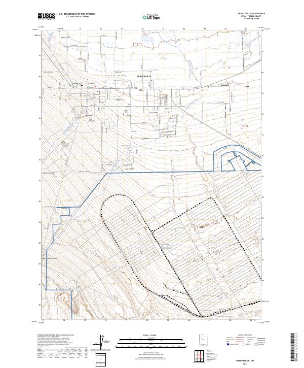
2023 Map of Grantsville
USGS Topo · Published 2023About this map
Tooele Valley transitions from the structured residential grid of Grantsville into the high-desert terrain of the Stansbury Mountains. The settlement pattern here is defined by historical transportation corridors, notably the Old Lincoln Hwy as it skirts the northwestern edge of town. South of the main residential center, the landscape is dominated by the sprawling footprint of the Tooele Army Depot, illustrating the intersection of military logistics and rural Utah geography. Water management is a central theme of this arid region, with features like Cooleys Slough, Blue Lake, and the runoff paths of North Willow Creek and South Willow Creek feeding into the basin. Genealogists and local historians can locate the Grantsville City Cem near the heart of the community, while the outlying settlements of Marshall and Erda mark the eastern limits of the map near the Oquirrh foothills.
Find a feature on this map
85 named features on this map. Tap any name to fly to it.
Don’t see what you’re looking for? This feature index may not catch every label — zoom into the map to look around manually.
Map Details
Editions of this 2023 Grantsville Map
This is the sole edition of this map. No revisions or reprints were ever made.
Other maps of this area

1885 · Tooele Valley
USGS Topo · 1:250,000

1918 · Stockton
USGS Topo · 1:62,500

1953 · Tooele
USGS Topo · 1:250,000

1955 · Timpie
USGS Topo · 1:62,500

1955 · Mills Junction
USGS Topo · 1:24,000

1955 · Deseret Peak
USGS Topo · 1:62,500

1955 · Burmester
USGS Topo · 1:24,000

1955 · Grantsville
USGS Topo · 1:24,000

1955 · Stockton
USGS Topo · 1:62,500

1955 · Tooele
USGS Topo · 1:250,000