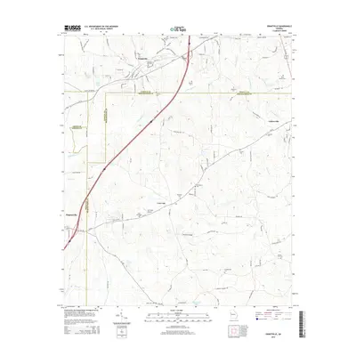
2014 Map of Grantville
USGS Topo · Published 2014About this map
Grantville sits at the intersection of Coweta, Meriwether, and Troup counties, serving as a focal point for this rural Georgia landscape. The map reveals a dense network of family and community landmarks, particularly evident in the high concentration of small burial grounds like Holly Springs Cem and Possum Trot Cem. These sites, alongside the Grantville City Cem, point to generations of settled families throughout the rolling terrain.
Find a feature on this map
104 named features on this map. Tap any name to fly to it.
Don’t see what you’re looking for? This feature index may not catch every label — zoom into the map to look around manually.
Map Details
Editions of this 2014 Grantville Map
This is the sole edition of this map. No revisions or reprints were ever made.
Other maps of this area

1953 · Atlanta
USGS Topo · 1:250,000

1957 · Atlanta
USGS Topo · 1:250,000

1958 · Atlanta
USGS Topo · 1:250,000

1964 · Hogansville
USGS Topo · 1:24,000
1964 · Mountville
USGS Topo · 1:24,000

1964 · Grantville
USGS Topo · 1:24,000
1964 · Odessadale
USGS Topo · 1:24,000

1965 · Newnan South
USGS Topo · 1:24,000
1965 · Newnan SW
USGS Topo · 1:24,000

1965 · Sharpsburg
USGS Topo · 1:24,000