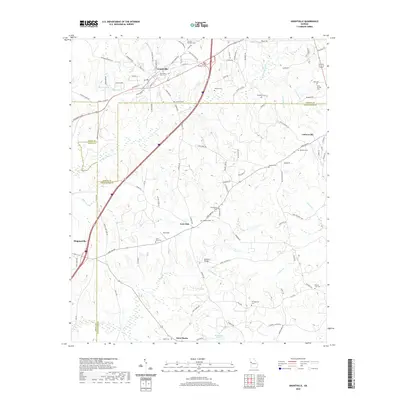
2020 Map of Grantville
USGS Topo · Published 2020About this map
Grantville serves as the primary hub in this Georgia landscape, situated at the convergence of several rural routes and the headwaters of Yellowjacket Cr. The area is characterized by a dense concentration of small burial grounds and family plots, which offer significant value for genealogical research in this portion of Coweta, Meriwether, and Troup counties. Features such as the Samuel Meadows Cem and John C Meadows Cem near the northern border, along with the Grantville City Cem, document the generations of families who settled these crossroads.
Find a feature on this map
102 named features on this map. Tap any name to fly to it.
Don’t see what you’re looking for? This feature index may not catch every label — zoom into the map to look around manually.
Map Details
Editions of this 2020 Grantville Map
This is the sole edition of this map. No revisions or reprints were ever made.
Other maps of this area

1953 · Atlanta
USGS Topo · 1:250,000

1957 · Atlanta
USGS Topo · 1:250,000

1958 · Atlanta
USGS Topo · 1:250,000

1964 · Hogansville
USGS Topo · 1:24,000
1964 · Mountville
USGS Topo · 1:24,000

1964 · Grantville
USGS Topo · 1:24,000
1964 · Odessadale
USGS Topo · 1:24,000

1965 · Newnan South
USGS Topo · 1:24,000
1965 · Newnan SW
USGS Topo · 1:24,000

1965 · Sharpsburg
USGS Topo · 1:24,000