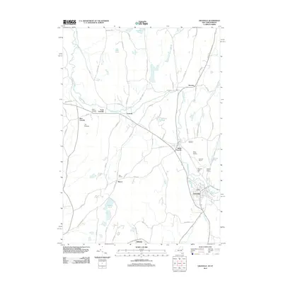
2012 Map of Granville
USGS Topo · Published 2012About this map
Granville and its surrounding hamlets are defined by the winding course of the Mettawee River and Indian River in this eastern New York landscape. This 2012 survey documents a series of established settlements including North Granville, Middle Granville, West Granville, and Truthville, each positioned along the local road and waterway network. The map reveals a high density of burial grounds essential for genealogical research, such as Elmwood Cemetery, North Granville Cemetery, and the Quaker Cemetery near the heart of town. Agricultural and community landmarks like Hicks Orchard and Mettawee Valley Farm sit alongside transit infrastructure like the Granville Airport. The presence of several named ponds, including Gillespie Pond and Martins Pond, highlights the water-rich geography of the valley below the heights of The Pinnacle.
Find a feature on this map
64 named features on this map. Tap any name to fly to it.
Don’t see what you’re looking for? This feature index may not catch every label — zoom into the map to look around manually.
Map Details
Editions of this 2012 Granville Map
This is the sole edition of this map. No revisions or reprints were ever made.
Other maps of this area

1893 · Fort Ann
USGS Topo · 1:62,500

1893 · Whitehall
USGS Topo · 1:62,500

1894 · Pawlet
USGS Topo · 1:62,500

1895 · Whitehall
USGS Topo · 1:62,500

1895 · Fort Ann
USGS Topo · 1:62,500

1895 · Castleton
USGS Topo · 1:62,500

1897 · Pawlet
USGS Topo · 1:62,500

1897 · Castleton
USGS Topo · 1:62,500

1898 · Whitehall
USGS Topo · 1:62,500

1898 · Fort Ann
USGS Topo · 1:62,500