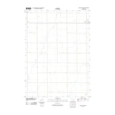
2010 Map of Granville West
USGS Topo · Published 2010About this map
Granville anchors the northeast corner of this Sioux County landscape, where the town's grid meets the expansive agricultural section lines of northwest Iowa. The terrain is defined by a subtle drainage system flowing toward the south and west, led by the winding path of Willow Creek and the southern reaches of Deep Creek. This 2010 survey illustrates the rigid precision of the rural road network, with numbered thoroughfares like 450th St and 500th St intersecting named avenues such as Larch Ave and Shamrock Ave. In the southeast, the small Kerr Airport stands as a local aviation landmark amongst the cultivated fields. The map captures a moment of modern rural stability, documenting the relationship between the concentrated settlement at Granville and the meticulously partitioned farmland that surrounds it.
Find a feature on this map
22 named features on this map. Tap any name to fly to it.
Don’t see what you’re looking for? This feature index may not catch every label — zoom into the map to look around manually.
Map Details
Editions of this 2010 Granville West Map
This is the sole edition of this map. No revisions or reprints were ever made.
Other maps of this area

1954 · Fairmont
USGS Topo · 1:250,000

1954 · Fort Dodge
USGS Topo · 1:250,000

1955 · Sioux City
USGS Topo · 1:250,000

1955 · Sioux Falls
USGS Topo · 1:250,000

1957 · Fort Dodge
USGS Topo · 1:250,000

1958 · Sioux City
USGS Topo · 1:250,000

1958 · Sioux Falls
USGS Topo · 1:250,000

1958 · Fort Dodge
USGS Topo · 1:250,000

1958 · Fairmont
USGS Topo · 1:250,000

1959 · Sioux City
USGS Topo · 1:250,000