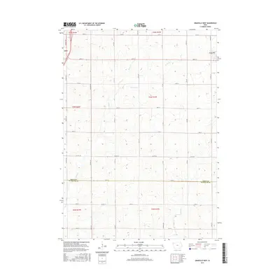
2015 Map of Granville West
USGS Topo · Published 2015About this map
Alton and Granville anchor this section of Northwest Iowa, where the landscape is defined by the agricultural grid and the natural drainage of the Big Sioux River watershed. The terrain is intricately etched by several small waterways, including Willow Cr, Granville Cr, and Deep Cr, which meander through the high-productivity farmland of the Floyd River valley region. This survey captures the rural infrastructure of the mid-2010s, showing a dense network of county highways and section-line roads like Co Hwy B62 and Co Hwy L22 that facilitate the transport of livestock and grain. The map also delineates the jurisdictional boundary at the Sioux Co Plymouth Co line, providing a precise look at the township divisions between T95N and T93N that have governed land ownership in this part of the state for generations.
Find a feature on this map
35 named features on this map. Tap any name to fly to it.
Don’t see what you’re looking for? This feature index may not catch every label — zoom into the map to look around manually.
Map Details
Editions of this 2015 Granville West Map
This is the sole edition of this map. No revisions or reprints were ever made.
Other maps of this area

1954 · Fairmont
USGS Topo · 1:250,000

1954 · Fort Dodge
USGS Topo · 1:250,000

1955 · Sioux City
USGS Topo · 1:250,000

1955 · Sioux Falls
USGS Topo · 1:250,000

1957 · Fort Dodge
USGS Topo · 1:250,000

1958 · Sioux City
USGS Topo · 1:250,000

1958 · Sioux Falls
USGS Topo · 1:250,000

1958 · Fort Dodge
USGS Topo · 1:250,000

1958 · Fairmont
USGS Topo · 1:250,000

1959 · Sioux City
USGS Topo · 1:250,000