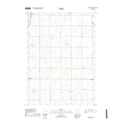
2018 Map of Granville West
USGS Topo · Published 2018About this map
Alton and Granville anchor this agricultural landscape in northwestern Iowa, where the high prairie is defined by a rigorous section-line road grid. The boundary between Sioux Co and Plymouth Co runs horizontally across the lower third of the quadrangle, marked by 510th St. This area is characterized by the headwaters of several drainage systems, including the southward-flowing Willow Creek and the eastward-trending Granville Creek. The map documents a landscape almost entirely shaped by modern commercial farming, with a dense network of local routes like Co Hwy B62 and 460th St connecting the scattered farmsteads that populate the townships of t94n r44w and t94n r43w. The survey provides a clear view of how political boundaries and transport corridors intersect with the natural flow of Deep Creek near the southern border.
Find a feature on this map
21 named features on this map. Tap any name to fly to it.
Don’t see what you’re looking for? This feature index may not catch every label — zoom into the map to look around manually.
Map Details
Editions of this 2018 Granville West Map
This is the sole edition of this map. No revisions or reprints were ever made.
Other maps of this area

1954 · Fairmont
USGS Topo · 1:250,000

1954 · Fort Dodge
USGS Topo · 1:250,000

1955 · Sioux City
USGS Topo · 1:250,000

1955 · Sioux Falls
USGS Topo · 1:250,000

1957 · Fort Dodge
USGS Topo · 1:250,000

1958 · Sioux City
USGS Topo · 1:250,000

1958 · Sioux Falls
USGS Topo · 1:250,000

1958 · Fort Dodge
USGS Topo · 1:250,000

1958 · Fairmont
USGS Topo · 1:250,000

1959 · Sioux City
USGS Topo · 1:250,000