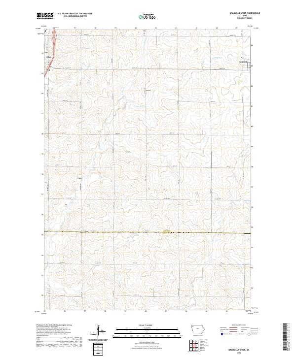
2022 Map of Granville West
USGS Topo · Published 2022About this map
Granville and Alton anchor this corner of Sioux County, where the agricultural grid of northwest Iowa is carved by the meandering courses of Granville Cr and Willow Cr. The landscape is defined by its Section Line roads, which form a regular mesh of gravel and paved thoroughfares such as Larch Ave and 470th St. This 2022 survey illustrates the enduring nature of the township-and-range system, with modern rural addresses and county highways like Co Hwy L22 facilitating local transport between family farmsteads. To the south, the boundary between Sioux Co and Plymouth Co runs along 510th St, marking a jurisdictional transition just north of Deep Cr. The map provides a clear look at the spatial organization of these prairie communities, where small-town centers remain the primary hubs of local industry and social life.
Find a feature on this map
33 named features on this map. Tap any name to fly to it.
Don’t see what you’re looking for? This feature index may not catch every label — zoom into the map to look around manually.
Map Details
Editions of this 2022 Granville West Map
This is the sole edition of this map. No revisions or reprints were ever made.
Other maps of this area

1954 · Fairmont
USGS Topo · 1:250,000

1954 · Fort Dodge
USGS Topo · 1:250,000

1955 · Sioux City
USGS Topo · 1:250,000

1955 · Sioux Falls
USGS Topo · 1:250,000

1957 · Fort Dodge
USGS Topo · 1:250,000

1958 · Sioux City
USGS Topo · 1:250,000

1958 · Sioux Falls
USGS Topo · 1:250,000

1958 · Fort Dodge
USGS Topo · 1:250,000

1958 · Fairmont
USGS Topo · 1:250,000

1959 · Sioux City
USGS Topo · 1:250,000