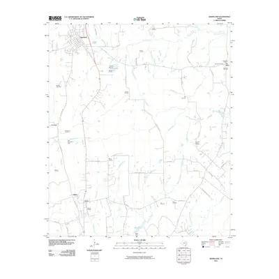
2010 Map of Grapeland
USGS Topo · Published 2010About this map
Grapeland serves as the primary hub in this portion of Houston County, where State Loop 531 and Main St organize the local grid. The landscape is characterized by a high density of small family and community burial grounds, such as Murdock Cemetery, Denson Cemetery, and McCarthy Chapel Cemetery, which offer valuable locations for genealogical research. To the southeast, the settlement of Latexo sits near the Bruner Airport, while the community of San Pedro remains centered around the San Pedro Post Office and San Pedro Cemetery. Numerous small waterways, including Stroud Branch and Stowe Creek, drain toward larger basins like Bison Lake. The network of farm-to-market roads, such as FM 2423 and FM 2022, connects these dispersed settlements and agricultural tracts, reflecting the enduring rural infrastructure of East Texas.
Find a feature on this map
69 named features on this map. Tap any name to fly to it.
Don’t see what you’re looking for? This feature index may not catch every label — zoom into the map to look around manually.
Map Details
Editions of this 2010 Grapeland Map
This is the sole edition of this map. No revisions or reprints were ever made.
Other maps of this area

1950 · Crockett
USGS Topo · 1:24,000

1950 · Crockett NE
USGS Topo · 1:24,000

1951 · Crockett
USGS Topo · 1:24,000

1951 · Grapeland
USGS Topo · 1:24,000

1951 · Berea
USGS Topo · 1:24,000

1951 · Crockett NE
USGS Topo · 1:24,000

1951 · Elkhart
USGS Topo · 1:62,500

1952 · Slocum
USGS Topo · 1:62,500

1953 · Palestine
USGS Topo · 1:250,000

1957 · Palestine
USGS Topo · 1:250,000