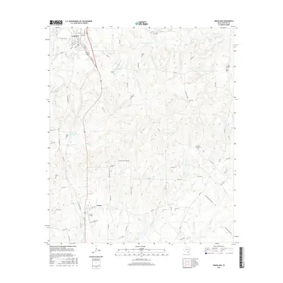
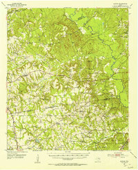
2016 Map of Grapeland
USGS Topo · Published 2016About this map
Grapeland sits at the northern edge of this Houston County landscape, where the street grid transitions into a network of country roads and creek drainages. The area is defined by its deep genealogical roots, evidenced by numerous small family and community burial grounds such as Murdock Cem, Milligan Cem, and McCarthy Chapel Cem. These sites are often found on high ground overlooking the complex web of local waterways, including Bennett Cr, Stroud Br, and the Tyer Br drainage system. South of the main town, Latexo Cem and Bruner Airport mark the vicinity of Latexo. The terrain is dotted with several significant water bodies like Barfield Lake and M R Murchison Lake, while the eastern portion of the survey is characterized by the headwaters of San Pedro Cr and the notable Boiling Spring.
Find a feature on this map
89 named features on this map. Tap any name to fly to it.
Don’t see what you’re looking for? This feature index may not catch every label — zoom into the map to look around manually.
Map Details
Editions of this 2016 Grapeland Map
This is the sole edition of this map. No revisions or reprints were ever made.
Other maps of this area
1950 · Crockett
USGS Topo · 1:24,000
1950 · Crockett NE
USGS Topo · 1:24,000
1951 · Crockett
USGS Topo · 1:24,000
1951 · Grapeland
USGS Topo · 1:24,000
1951 · Berea
USGS Topo · 1:24,000
1951 · Crockett NE
USGS Topo · 1:24,000
1951 · Elkhart
USGS Topo · 1:62,500
1952 · Slocum
USGS Topo · 1:62,500

1953 · Palestine
USGS Topo · 1:250,000

1957 · Palestine
USGS Topo · 1:250,000