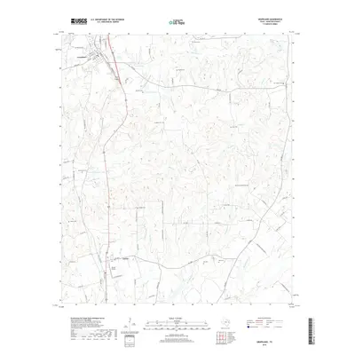
2019 Map of Grapeland
USGS Topo · Published 2019About this map
Grapeland and the smaller community of Latexo anchor this survey of central Houston County, where a complex network of creeks and branches dissects the East Texas landscape. The region's genealogy is preserved in numerous family and community burial grounds, including the New Salem Cem, Milligan Cem, and the McCarthy Chapel Cem. Water defines the area's geography, with Bennett Cr and San Pedro Cr winding through the northern reaches, while M R Murchison Lake and Barfield Lake provide significant local landmarks. Transportation is centered on the corridor between the two main settlements, complemented by the specialized Bruner Airport south of Latexo. Small rural congregations like the Countryside Bap Church serve as social touchpoints in an area otherwise dominated by tributary streams like Stroud Br and Mayes Br.
Find a feature on this map
92 named features on this map. Tap any name to fly to it.
Don’t see what you’re looking for? This feature index may not catch every label — zoom into the map to look around manually.
Map Details
Editions of this 2019 Grapeland Map
This is the sole edition of this map. No revisions or reprints were ever made.
Other maps of this area

1950 · Crockett
USGS Topo · 1:24,000

1950 · Crockett NE
USGS Topo · 1:24,000

1951 · Crockett
USGS Topo · 1:24,000

1951 · Grapeland
USGS Topo · 1:24,000

1951 · Berea
USGS Topo · 1:24,000

1951 · Crockett NE
USGS Topo · 1:24,000

1951 · Elkhart
USGS Topo · 1:62,500

1952 · Slocum
USGS Topo · 1:62,500

1953 · Palestine
USGS Topo · 1:250,000

1957 · Palestine
USGS Topo · 1:250,000