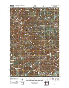
2011 Map of Grass Mountain
USGS Topo · Published 2011About this map
Grass Mountain and the surrounding Coast Range peaks define this landscape of deep creek drainages and timbered ridges. The Fall Creek Fish Hatchery sits along the lower reaches of Fall Creek near where the waters join the North Fork Alsea River, illustrating the intersection of natural resources and state management. Higher elevations are marked by distinctive landmarks such as Little Digger Mountain and LoneSpring Mountain, while remote access is maintained through a network of forest routes including Grass Mountain Rd and Fall Creek Rd. Settlement is sparse, with Sharp Ranch appearing as a primary named property among the অসংখ্য creek systems like Klickitat Creek and Bear Creek. The map documents a terrain primarily shaped by the hydrology of the Alsea watershed and the high peaks of the Oregon coastal interior.
Find a feature on this map
50 named features on this map. Tap any name to fly to it.
Don’t see what you’re looking for? This feature index may not catch every label — zoom into the map to look around manually.
Map Details
Editions of this 2011 Grass Mountain Map
This is the sole edition of this map. No revisions or reprints were ever made.
Other maps of this area

1939 · Marys Peak
USGS Topo · 1:62,500

1942 · Marys Peak
USGS Topo · 1:62,500

1942 · Alsea
USGS Topo · 1:62,500

1942 · Tidewater
USGS Topo · 1:62,500

1942 · Toledo
USGS Topo · 1:62,500

1953 · Salem
USGS Topo · 1:250,000

1954 · Salem
USGS Topo · 1:250,000

1956 · Alsea
USGS Topo · 1:62,500

1956 · Tidewater
USGS Topo · 1:62,500

1957 · Marys Peak
USGS Topo · 1:62,500