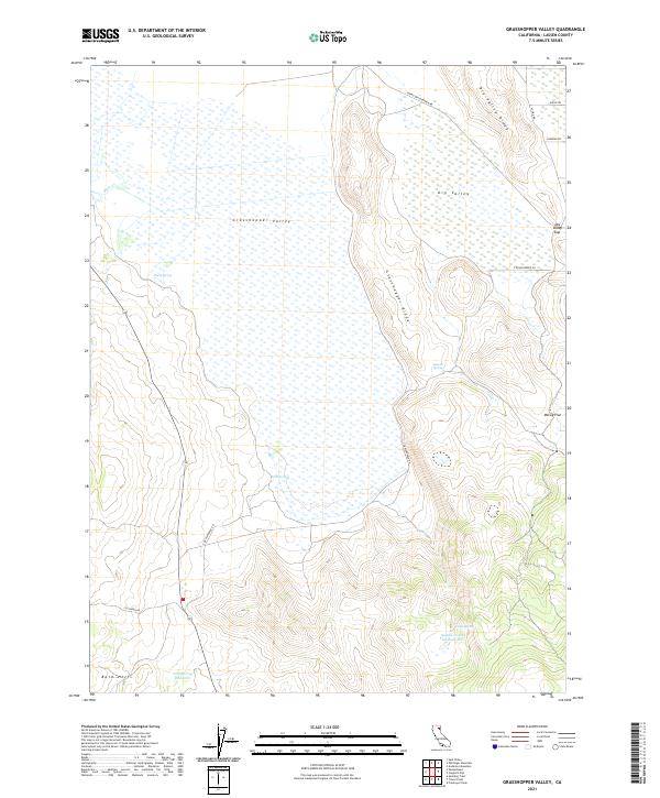
2021 Map of Grasshopper Valley
USGS Topo · Published 2021About this map
Grasshopper Valley dominates this high-altitude landscape in Lassen County, where seasonal hydrology and remote ranching infrastructure define the terrain. The valley floor is flanked by the prominent Grasshopper Ridge to the east and the Bald Hills to the southwest, creating a classic Great Basin basin-and-range profile. Water management is central to the area's utility, evidenced by the presence of the Saddle Horse Flat Reservoir and Tom Spring Reservoir, along with numerous isolated water sources like York Springs and Luddy Spring. In the northeast corner, Dry Valley and the Dry Valley Ridge show the transition toward Dry Valley Gap. The network of unpaved roads, including Termo Grasshopper Rd and S Grasshopper Rd, reveals the enduring reliance on these corridors for accessing livestock ranges and remote mountain tracts.
Find a feature on this map
26 named features on this map. Tap any name to fly to it.
Don’t see what you’re looking for? This feature index may not catch every label — zoom into the map to look around manually.
Map Details
Editions of this 2021 Grasshopper Valley Map
This is the sole edition of this map. No revisions or reprints were ever made.
Other maps of this area

1886 · Honey Lake
USGS Topo · 1:250,000

1891 · Honey Lake
USGS Topo · 1:250,000

1893 · Honey Lake
USGS Topo · 1:250,000

1954 · Grasshopper Valley
USGS Topo · 1:62,500

1954 · Fredonyer Peak
USGS Topo · 1:62,500

1955 · Westwood
USGS Topo · 1:250,000

1956 · Hayden Hill
USGS Topo · 1:62,500

1956 · Antelope Mtn
USGS Topo · 1:62,500

1958 · Westwood
USGS Topo · 1:250,000

1959 · Westwood
USGS Topo · 1:250,000