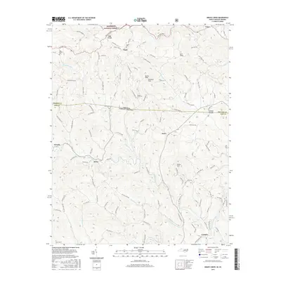
2016 Map of Grassy Creek
USGS Topo · Published 2016About this map
The North Fork New River meanders through the southern portion of this borderland terrain where North Carolina meets Virginia. The landscape is defined by the high ridges of the Jefferson National Forest to the north, including Blackburn Knob and Helton Knob. Small settlements and family crossroads like Helton, Rugby, and Crumpler are linked by a network of winding valley roads such as Silas Creek Rd and Grassy Creek Rd. Numerous small burial grounds, including Greenwood Cem, Haw Orchard Cem, and New River Cem, are scattered across the hillsides, providing a detailed record of the area's ancestral residents. The map captures the rural character of the region as it appeared in the mid-2010s, showing the clear relationship between the steep Appalachian topography and the placement of farms and cemeteries along the primary watercourses like Wilson Creek and Little Helton Cr.
Find a feature on this map
110 named features on this map. Tap any name to fly to it.
Don’t see what you’re looking for? This feature index may not catch every label — zoom into the map to look around manually.
Map Details
Editions of this 2016 Grassy Creek Map
This is the sole edition of this map. No revisions or reprints were ever made.
Other maps of this area

1889 · Wytheville
USGS Topo · 1:125,000

1889 · Wilkesboro
USGS Topo · 1:125,000

1891 · Abingdon
USGS Topo · 1:125,000

1891 · Wilkesboro
USGS Topo · 1:125,000

1892 · Wytheville
USGS Topo · 1:125,000

1893 · Cranberry
USGS Topo · 1:125,000

1894 · Abingdon
USGS Topo · 1:125,000

1895 · Cranberry
USGS Topo · 1:125,000

1899 · Cranberry
USGS Topo · 1:125,000

1902 · Cranberry
USGS Topo · 1:125,000