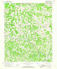
1966 Map of Grassy Creek
USGS Topo · Published 1968About this map
Helton and Grassy Creek districts meet at the state line in this mid-1960s survey of the Blue Ridge highlands. The landscape is defined by the sharp winding course of the North Fork New River, which carves around Walnut Hill near the settlement of Crumpler. This area is dense with small rural congregations and burial grounds, such as Corinth Ch and Greenwood Cem, reflecting a deeply rooted mountain community.
Find a feature on this map
51 named features on this map. Tap any name to fly to it.
Don’t see what you’re looking for? This feature index may not catch every label — zoom into the map to look around manually.
Map Details
Editions of this 1966 Grassy Creek Map
2 editions found
Other maps of this area

1889 · Wytheville
USGS Topo · 1:125,000

1889 · Wilkesboro
USGS Topo · 1:125,000

1891 · Abingdon
USGS Topo · 1:125,000

1891 · Wilkesboro
USGS Topo · 1:125,000

1892 · Wytheville
USGS Topo · 1:125,000

1893 · Cranberry
USGS Topo · 1:125,000

1894 · Abingdon
USGS Topo · 1:125,000

1895 · Cranberry
USGS Topo · 1:125,000

1899 · Cranberry
USGS Topo · 1:125,000

1902 · Cranberry
USGS Topo · 1:125,000