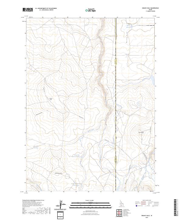
2023 Map of Grassy Hills
USGS Topo · Published 2023About this map
Grassy Hills dominate this high-desert landscape along the administrative boundary between Owyhee County and Twin Falls County. The map reveals a complex water management system essential for livestock and ranching in this arid Idaho terrain, featuring a series of catchments including Grassy Hills Reservoir Number Two, Grassy Hills Reservoir Number Three, and the Little Grassy Reservoir. The local economy is anchored by the House Creek Ranch, situated near the confluence of House Creek and Little House Creek. Transportation in this remote corner of the state is defined by long-established routes such as House Creek Road and Three Creek Road, while significant drainage features like Devil Creek and the Worley Ditch illustrate the ongoing effort to direct seasonal runoff through the draws and sloughs of the Owyhee plateau.
Find a feature on this map
25 named features on this map. Tap any name to fly to it.
Don’t see what you’re looking for? This feature index may not catch every label — zoom into the map to look around manually.
Map Details
Editions of this 2023 Grassy Hills Map
This is the sole edition of this map. No revisions or reprints were ever made.
Other maps of this area

1955 · Twin Falls
USGS Topo · 1:250,000

1958 · Twin Falls
USGS Topo · 1:250,000

1964 · Roseworth
USGS Topo · 1:24,000

1977 · Cedar Creek Reservoir
USGS Topo · 1:24,000

1978 · Taylor Canyon
USGS Topo · 1:24,000

1979 · Salls Crossing
USGS Topo · 1:24,000
1979 · Roseworth
USGS Topo · 1:24,000
1979 · Three Creek
USGS Topo · 1:24,000

1979 · Coonskin Butte
USGS Topo · 1:24,000
1980 · Curtis Draw
USGS Topo · 1:24,000