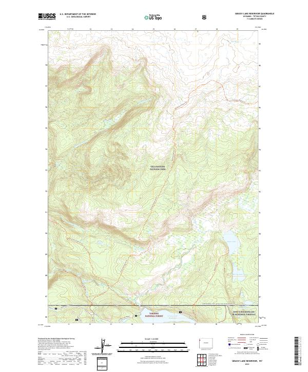
2021 Map of Grassy Lake Reservoir
USGS Topo · Published 2021About this map
Yellowstone National Park and the adjacent Targhee National Forest meet at a landscape defined by significant falls and high mountain hydrology. The terrain is notably marked by the Fall River and its tributaries, where remote water features like Union Falls, Terraced Falls, and Cascade Falls characterize the drainage patterns of the Pitchstone Plateau Trl. Near the southern boundary of the park, the John D Rockefeller Jr Memorial Parkway provides access toward Camp Loll and the Grassy Lake Reservoir. This 2021 survey illustrates the complex network of backcountry trails, including the Mountain Ash Creek Trl and Beula Lake Trl, which connect high-altitude lakes such as Beula Lake and Hering Lake across the Wyoming wilderness.
Find a feature on this map
64 named features on this map. Tap any name to fly to it.
Don’t see what you’re looking for? This feature index may not catch every label — zoom into the map to look around manually.
Map Details
Editions of this 2021 Grassy Lake Reservoir Map
This is the sole edition of this map. No revisions or reprints were ever made.
Other maps of this area

1886 · Shoshone
USGS Topo · 1:125,000

1888 · Shoshone
USGS Topo · 1:125,000

1895 · Shoshone
USGS Topo · 1:125,000

1901 · Shoshone
USGS Topo · 1:125,000

1908 · Shoshone
USGS Topo · 1:125,000

1911 · Shoshone
USGS Topo · 1:125,000

1955 · Ashton
USGS Topo · 1:250,000
1956 · West Thumb
USGS Topo · 1:62,500

1956 · Old Faithful
USGS Topo · 1:62,500

1956 · Grassy Lake Reservoir
USGS Topo · 1:62,500