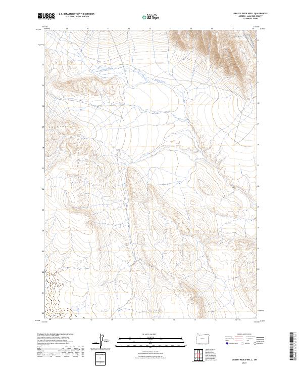
2023 Map of Grassy Ridge Well
USGS Topo · Published 2023About this map
Grassy Ridge rises above the drainage of Wildcat Creek in this remote section of Malheur County. The landscape is defined by the high, undulating terrain of the high desert, where watercourses like Wildcat Creek have carved deep into the plateau. The survey area is almost entirely undeveloped, with only N Fork Ryegrass Creek Rd providing access through the northeastern corner near Bone Canyon. This map documents the Public Land Survey System (PLSS) grid across townships t32s r37e, t32s r38e, t33s r37e, and t33s r38e, providing a precise record of section lines in a region where few permanent human markers exist. It is a portrait of a landscape preserved in its natural state, showing the intricate relationship between elevation and seasonal drainage.
Find a feature on this map
8 named features on this map. Tap any name to fly to it.
Don’t see what you’re looking for? This feature index may not catch every label — zoom into the map to look around manually.
Map Details
Editions of this 2023 Grassy Ridge Well Map
This is the sole edition of this map. No revisions or reprints were ever made.
Other maps of this area

1955 · Jordan Valley
USGS Topo · 1:250,000

1955 · Adel
USGS Topo · 1:250,000

1957 · Adel
USGS Topo · 1:250,000

1957 · Jordan Valley
USGS Topo · 1:250,000

1958 · Adel
USGS Topo · 1:250,000

1958 · Jordan Valley
USGS Topo · 1:250,000

1962 · Adel
USGS Topo · 1:250,000

1972 · Palomino Hills
USGS Topo · 1:24,000
1980 · Flat Top Mtn
USGS Topo · 1:24,000

1980 · Rome State Airport
USGS Topo · 1:24,000