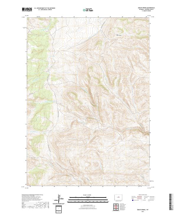
2021 Map of Grave Spring
USGS Topo · Published 2021About this map
Grave Spring serves as a central landmark in this high-altitude section of the Bighorn Mountains, where the headwaters of several major creek systems begin their descent. The drainage patterns are well-defined by the Middle Fork Powder River in the northwest and a complex network of Buffalo Creek branches, including the N Fork Buffalo Cr, Middle Fork Buffalo Cr, and S Fork Buffalo Cr. These water sources were historically vital for livestock and early travel through this portion of Natrona County.
Find a feature on this map
21 named features on this map. Tap any name to fly to it.
Don’t see what you’re looking for? This feature index may not catch every label — zoom into the map to look around manually.
Map Details
Editions of this 2021 Grave Spring Map
This is the sole edition of this map. No revisions or reprints were ever made.
Other maps of this area

1952 · Deadman Butte
USGS Topo · 1:24,000

1952 · Grave Spring
USGS Topo · 1:24,000

1952 · Badwater NE
USGS Topo · 1:24,000

1952 · Badwater SE
USGS Topo · 1:24,000

1955 · Arminto
USGS Topo · 1:250,000

1958 · Arminto
USGS Topo · 1:250,000

1962 · Arminto
USGS Topo · 1:250,000

1967 · Gordon Creek
USGS Topo · 1:24,000
1967 · Cherry Creek Hill
USGS Topo · 1:24,000
1967 · Lost Creek
USGS Topo · 1:24,000