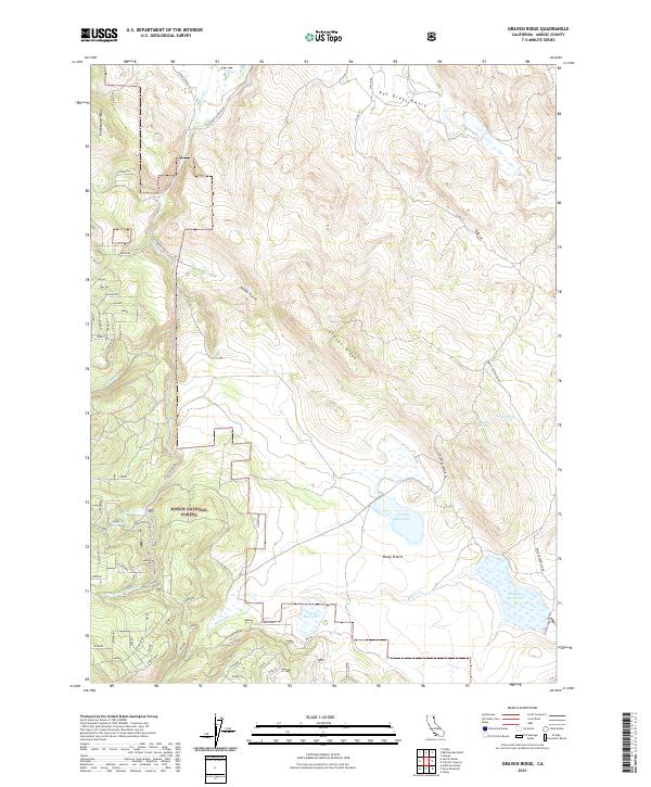
2021 Map of Graven Ridge
USGS Topo · Published 2021About this map
Modoc National Forest territory dominates this high-country landscape, where complex water management systems define the local geography. Significant catchment features like Graven Reservoir, Clarks Reservoir, and Bayley Reservoir are strategically positioned to capture seasonal runoff from the surrounding uplands. The terrain is marked by distinctive formations such as Graven Ridge and the Portuguese Ridge to the west, separated by drainages like Canyon Cr and the S Fork Canyon Cr. This network of springs—including Lundsford Spring, Arnett Spring, and Big John Spring—indicates the vital role of groundwater in sustaining both the ecology and the local ranching or forestry infrastructure of this Modoc County region. The residential and access patterns are clustered along named corridors like California Pines Blvd, which contrast with the open expanses of Rocky Prairie and Rye Grass Swale.
Find a feature on this map
67 named features on this map. Tap any name to fly to it.
Don’t see what you’re looking for? This feature index may not catch every label — zoom into the map to look around manually.
Map Details
Editions of this 2021 Graven Ridge Map
This is the sole edition of this map. No revisions or reprints were ever made.
Other maps of this area

1886 · Alturas
USGS Topo · 1:250,000

1892 · Alturas
USGS Topo · 1:250,000

1954 · Alturas
USGS Topo · 1:250,000

1958 · Alturas
USGS Topo · 1:250,000

1961 · Canby
USGS Topo · 1:62,500

1961 · Alturas
USGS Topo · 1:62,500

1962 · Alturas
USGS Topo · 1:250,000
1962 · Adin
USGS Topo · 1:62,500

1962 · Likely
USGS Topo · 1:62,500

1965 · Alturas
USGS Topo · 1:250,000