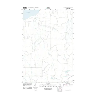
2011 Map of Graveraet River
USGS Topo · Published 2011About this map
The rocky shores of Lake Superior meet the dense interior of Michigan's Keweenaw Peninsula in this digital-era survey. The small settlement of Toivola serves as a primary point of human geography, positioned near the intersection of local roads and the headwaters of several coastal drainage systems. The landscape is defined by the drainage of the Graveraet and Elm rivers, which cut through the terrain toward the Great Lakes shoreline. This 2011 edition provides a clear record of modern property access and road networks in a region historically shaped by timber and mining, showing how the rural community of Toivola persists within the vast forested stretches of Houghton County.
Find a feature on this map
2 named features on this map. Tap any name to fly to it.
Don’t see what you’re looking for? This feature index may not catch every label — zoom into the map to look around manually.
Map Details
Editions of this 2011 Graveraet River Map
This is the sole edition of this map. No revisions or reprints were ever made.
Other maps of this area

1915 · Houghton
USGS Topo · 1:62,500

1946 · South Range
USGS Topo · 1:24,000

1948 · South Range
USGS Topo · 1:24,000

1954 · Graveraet River
USGS Topo · 1:24,000

1954 · Oskar
USGS Topo · 1:24,000

1954 · Beacon Hill
USGS Topo · 1:24,000

1954 · Rockhouse Point
USGS Topo · 1:24,000

1954 · Pelkie
USGS Topo · 1:62,500

1954 · Winona
USGS Topo · 1:62,500

1954 · Houghton
USGS Topo · 1:62,500