
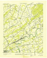
1935 Map of Graveston
USGS Topo · Published 1935About this map
Maynardville and Corryton anchor this 1935 survey of the ridge-and-valley landscape straddling the Union and Knox County line. The map illustrates a deeply rooted rural infrastructure of small schools and country churches that define early twentieth-century life in East Tennessee, including Millers Chapel, Little Flat Creek Ch, and Alder Springs Sch. The Southern railroad provides the primary industrial artery through the valleys, passing through the growing community of Corryton while several local roads like Highway No 33 begin to modernize the transit network.
Find a feature on this map
58 named features on this map. Tap any name to fly to it.
Don’t see what you’re looking for? This feature index may not catch every label — zoom into the map to look around manually.
Map Details
Editions of this 1935 Graveston Map
This is the sole edition of this map. No revisions or reprints were ever made.
Other maps of this area

1897 · Maynardville
USGS Topo · 1:125,000

1900 · Maynardville
USGS Topo · 1:125,000

1935 · Luttrell
USGS Topo · 1:24,000

1935 · Mascot
USGS Topo · 1:24,000

1935 · Straw Plains
USGS Topo · 1:48,000

1935 · Fountain City
USGS Topo · 1:24,000

1936 · Gorryton
USGS Topo · 1:48,000

1936 · Powder Springs
USGS Topo · 1:24,000

1936 · White Hollow
USGS Topo · 1:24,000
1936 · John Sevier
USGS Topo · 1:24,000