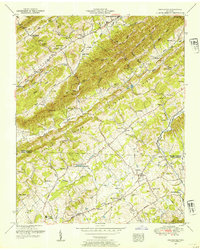
1952 Map of Graveston
USGS Topo · Published 1954About this map
Maynardville and the surrounding Tennessee ridge-and-valley landscape are documented here just as the post-war era began to reshape rural Union and Knox Counties. The terrain is defined by the prominent Copper Ridge and Raccoon Knobs, which dictate the placement of settlements and transport corridors. The southern portion of the map is anchored by the Southern Railway line through Corryton, a community featuring the Corryton School and an athletic field. This era shows a high density of rural institutions, from the Graveston Mill Pond to numerous family-named landmarks like Ousley Cemetery and Ailor Gap. A unique industrial feature appears near Birch Hollow, where minnow rearing pools are situated along the creek, suggesting specialized local land use alongside the traditional dairy and agricultural patterns of the Flat Creek area.
Find a feature on this map
79 named features on this map. Tap any name to fly to it.
Don’t see what you’re looking for? This feature index may not catch every label — zoom into the map to look around manually.
Map Details
Editions of this 1952 Graveston Map
4 editions found
Other maps of this area

1897 · Maynardville
USGS Topo · 1:125,000

1900 · Maynardville
USGS Topo · 1:125,000

1935 · Luttrell
USGS Topo · 1:24,000

1935 · Mascot
USGS Topo · 1:24,000

1935 · Straw Plains
USGS Topo · 1:48,000

1935 · Graveston
USGS Topo · 1:24,000

1935 · Fountain City
USGS Topo · 1:24,000

1936 · Gorryton
USGS Topo · 1:48,000

1936 · Powder Springs
USGS Topo · 1:24,000

1936 · White Hollow
USGS Topo · 1:24,000