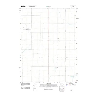
2010 Map of Gray
USGS Topo · Published 2010About this map
Gray and the small settlement of Ross anchor this portion of Audubon County, organized around a rigid grid of rural section roads and waterways. The local landscape is defined by the winding course of the East Nishnabotna River and Bluegrass Creek, which cut across the geometric lines of routes like Jay Ave and Heron Ave. Community anchors such as the Gray Post Office and the Heritage Rose Garden provide specific points of interest within the town site, while the Gray Cemetery and Cameron Cemetery offer vital reference points for those researching family ties in the region. The map also captures several distinctive water features, including Nabotna Pond and the headwaters of the East Branch West Nishnabotna River, illustrating the drainage patterns that have shaped agricultural life in this part of Iowa.
Find a feature on this map
34 named features on this map. Tap any name to fly to it.
Don’t see what you’re looking for? This feature index may not catch every label — zoom into the map to look around manually.
Map Details
Editions of this 2010 Gray Map
This is the sole edition of this map. No revisions or reprints were ever made.
Other maps of this area

1954 · Omaha
USGS Topo · 1:250,000

1957 · Omaha
USGS Topo · 1:250,000

1957 · Audubon
USGS Topo · 1:62,500

1958 · Omaha
USGS Topo · 1:250,000

1971 · Viola Center
USGS Topo · 1:24,000

1971 · Dedham
USGS Topo · 1:24,000

1971 · Templeton
USGS Topo · 1:24,000

1971 · Gray
USGS Topo · 1:24,000

1978 · Kimballton
USGS Topo · 1:24,000

1978 · Manning
USGS Topo · 1:24,000