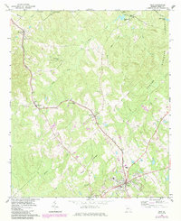
1964 Map of Gray
USGS Topo · Published 1984About this map
Gray serves as a central hub in Jones County, situated where the Central of Georgia railroad cuts southeast toward the historic community of Clinton. This map captures a landscape defined by small rail-stop settlements like Round Oak, Wayside, and Bradley, which are connected by the tracks and local roads. The educational heart of the rural area is represented by the Bradley-Wayside Sch, positioned between its namesake hamlets.
Find a feature on this map
24 named features on this map. Tap any name to fly to it.
Don’t see what you’re looking for? This feature index may not catch every label — zoom into the map to look around manually.
Map Details
Editions of this 1964 Gray Map
2 editions found
Other maps of this area

1953 · Athens
USGS Topo · 1:250,000

1956 · Gordon
USGS Topo · 1:62,500

1956 · Macon
USGS Topo · 1:62,500

1957 · Macon
USGS Topo · 1:250,000

1958 · Macon
USGS Topo · 1:250,000

1958 · Athens
USGS Topo · 1:250,000

1959 · Athens
USGS Topo · 1:250,000

1963 · Athens
USGS Topo · 1:250,000

1964 · Macon
USGS Topo · 1:250,000

1964 · Gray
USGS Topo · 1:24,000