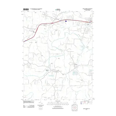
2012 Map of Gray Summit
USGS Topo · Published 2012About this map
The Diamonds and the surrounding river bottomlands define the geography of this Missouri corridor. The Meramec River winds through the center of the sheet, creating a complex hydrologic landscape of creeks like Pin Oak Creek and Winch Creek, alongside man-made water bodies such as Lake Serene and Evergreen Lakes. Small settlements like Catawissa, Robertsville, and Gray Summit are dispersed across the terrain, connected by a network of local roads and the prominent Interstate 44 corridor.
Find a feature on this map
140 named features on this map. Tap any name to fly to it.
Don’t see what you’re looking for? This feature index may not catch every label — zoom into the map to look around manually.
Map Details
Editions of this 2012 Gray Summit Map
This is the sole edition of this map. No revisions or reprints were ever made.
Other maps of this area

1901 · De Soto
USGS Topo · 1:125,000

1903 · O'Fallon
USGS Topo · 1:125,000

1937 · Pacific
USGS Topo · 1:24,000

1938 · Cedar Hill
USGS Topo · 1:24,000

1940 · Cedar Hill
USGS Topo · 1:24,000

1940 · Eureka
USGS Topo · 1:24,000

1944 · Eureka
USGS Topo · 1:24,000

1947 · St. Clair
USGS Topo · 1:62,500

1948 · Augusta
USGS Topo · 1:62,500

1949 · Saint Louis
USGS Topo · 1:250,000