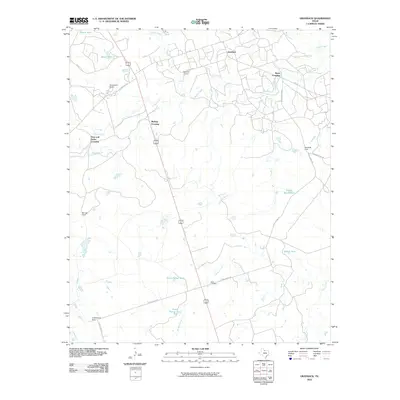
2010 Map of Grayback
USGS Topo · Published 2010About this map
Mack Cemetery and the crossroads at Grayback anchor this northern Texas landscape, where the ranching heritage of Wilbarger County is clearly evident. The map reveals a network of working lands and livestock infrastructure, including Zacaweista Ranch, Cottonwood Pens, and Burnett Pens. A primary transit corridor is formed by the combined routes of US 183 and 283, which intersect several local drainage points and crossings.
Find a feature on this map
34 named features on this map. Tap any name to fly to it.
Don’t see what you’re looking for? This feature index may not catch every label — zoom into the map to look around manually.
Map Details
Editions of this 2010 Grayback Map
This is the sole edition of this map. No revisions or reprints were ever made.
Other maps of this area

1954 · Wichita Falls
USGS Topo · 1:250,000

1955 · Lawton
USGS Topo · 1:250,000

1958 · Wichita Falls
USGS Topo · 1:250,000

1958 · Davidson
USGS Topo · 1:62,500

1958 · Vernon
USGS Topo · 1:62,500

1966 · Franklin Bend
USGS Topo · 1:24,000

1966 · Santa Rosa Lake
USGS Topo · 1:24,000

1966 · Grayback
USGS Topo · 1:24,000
1966 · Lake Electra
USGS Topo · 1:24,000

1966 · Northeast Lake Kemp
USGS Topo · 1:24,000