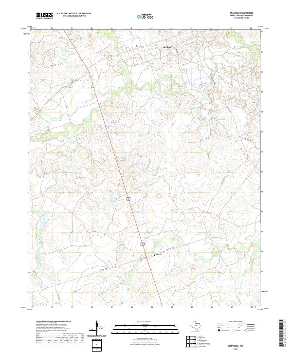
2022 Map of Grayback
USGS Topo · Published 2022About this map
Grayback serves as a central hub in this corner of North Texas, situated at the intersection of a sprawling network of county roads and drainage systems. The landscape is defined by the headwaters and tributaries of several prominent creeks, including Beaver Cr, Lillus Cr, and Minnas Cr, which carve through the plains. The presence of numerous named earthen dams and water catchments, such as Stone Tank, Flax Tank, and Diving Board Tank, underscores the critical role of water management in this livestock-focused environment. Genealogists and local historians will find the Mack Cem located near the junction of Diving Board Rd and the highway, a quiet landmark amidst the surrounding ranch lands. This 2022 survey captures the modern ranching infrastructure, from the Hereford Pens Rd to the strategic positioning of the North Parker Tank and South Parker Tank.
Find a feature on this map
29 named features on this map. Tap any name to fly to it.
Don’t see what you’re looking for? This feature index may not catch every label — zoom into the map to look around manually.
Map Details
Editions of this 2022 Grayback Map
This is the sole edition of this map. No revisions or reprints were ever made.
Other maps of this area

1954 · Wichita Falls
USGS Topo · 1:250,000

1955 · Lawton
USGS Topo · 1:250,000

1958 · Wichita Falls
USGS Topo · 1:250,000

1958 · Davidson
USGS Topo · 1:62,500

1958 · Vernon
USGS Topo · 1:62,500

1966 · Franklin Bend
USGS Topo · 1:24,000

1966 · Santa Rosa Lake
USGS Topo · 1:24,000

1966 · Grayback
USGS Topo · 1:24,000
1966 · Lake Electra
USGS Topo · 1:24,000

1966 · Northeast Lake Kemp
USGS Topo · 1:24,000