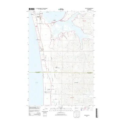
2014 Map of Grayland
USGS Topo · Published 2014About this map
Pacific Ocean tides meet the coastal communities of Washington’s southern shoreline in this contemporary survey. The landscape is defined by the narrow strip of land between the sea and the winding Elk River, featuring the cranberry-growing hub of Grayland and the quirky Grayland Intergalactic Airport. Settlement patterns follow the coast from Westport and Cohassett Beach in the north down toward the Pacific County line, where the Grayland Beach State Park preserves the natural dunes. Inland, the terrain rises into Seastrand Ridge and is crisscrossed by watercourses like Mallard Slough and Andrews Cr. This era shows a mix of recreation and traditional land use, from the Kenanna Recreational Vehicle Park to the established Roberts Farm, illustrating the region's transition into a destination for coastal tourism while maintaining its agricultural roots.
Find a feature on this map
68 named features on this map. Tap any name to fly to it.
Don’t see what you’re looking for? This feature index may not catch every label — zoom into the map to look around manually.
Map Details
Editions of this 2014 Grayland Map
This is the sole edition of this map. No revisions or reprints were ever made.
Other maps of this area

1938 · Cape Shoalwater
USGS Topo · 1:62,500

1938 · South Bend
USGS Topo · 1:62,500

1940 · South Bend
USGS Topo · 1:62,500

1941 · Grayland
USGS Topo · 1:62,500

1943 · Copalis Beach
USGS Topo · 1:250,000

1951 · Copalis Beach
USGS Topo · 1:250,000

1953 · Hoquiam
USGS Topo · 1:250,000

1955 · Point Brown
USGS Topo · 1:24,000
1956 · North Cove
USGS Topo · 1:24,000
1956 · Westport
USGS Topo · 1:24,000