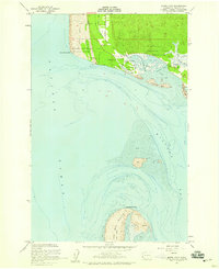
1956 Map of North Cove
USGS Topo · Published 1959About this map
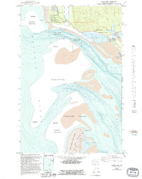
The shifting sands of the Washington coast define this mid-century survey where Willapa Bay meets the Pacific Ocean. The landscape is dominated by tidal dynamics, evidenced by features like Graveyard Spit and Empire Spit, while the Willapa National Wildlife Refuge and the Shoalwater Indian Reservation anchor the northern shoreline. Small coastal settlements such as North Cove and the evocative Dexter by the Sea are located near the bay's entrance, providing a record of residential patterns before significant coastal erosion further altered this shoreline.
Find a feature on this map
23 named features on this map. Tap any name to fly to it.
Don’t see what you’re looking for? This feature index may not catch every label — zoom into the map to look around manually.
Map Details
Editions of this 1956 North Cove Map
5 editions found
Other maps of this area

1938 · Cape Shoalwater
USGS Topo · 1:62,500

1938 · South Bend
USGS Topo · 1:62,500

1940 · South Bend
USGS Topo · 1:62,500

1941 · Grayland
USGS Topo · 1:62,500

1943 · Copalis Beach
USGS Topo · 1:250,000

1951 · Copalis Beach
USGS Topo · 1:250,000

1953 · Hoquiam
USGS Topo · 1:250,000
1956 · Grayland
USGS Topo · 1:24,000

1956 · Western
USGS Topo · 1:24,000

1957 · Hoquiam
USGS Topo · 1:250,000