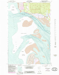
1956 Map of North Cove
USGS Topo · Published 1985About this map
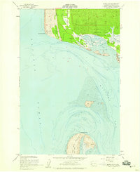
Cape Shoalwater and the shifting sands of Willapa Bay define this mid-century portrait of the Washington coast. The landscape is dominated by the dynamic nature of the shoreline, with multiple coastal zones explicitly marked as an Area subject to frequent change. This survey captures the small coastal settlements of North Cove and Dexter by the Sea, located just west of the Shoalwater Indian Reservation. Local history is anchored at the Georgetown Cemetery, while the natural environment is preserved within the expansive Willapa National Wildlife Refuge. To the south, the long reach of the Peninsula terminates at Leadbetter Point, separated from the mainland by a complex network of breakers and tidal flats. The interior terrain shows the utility of the land through features like Drainage Ditch No 1, reflecting the local effort to manage the low-lying coastal plains.
Find a feature on this map
20 named features on this map. Tap any name to fly to it.
Don’t see what you’re looking for? This feature index may not catch every label — zoom into the map to look around manually.
Map Details
Editions of this 1956 North Cove Map
5 editions found
Other maps of this area

1938 · Cape Shoalwater
USGS Topo · 1:62,500

1938 · South Bend
USGS Topo · 1:62,500

1940 · South Bend
USGS Topo · 1:62,500

1941 · Grayland
USGS Topo · 1:62,500

1943 · Copalis Beach
USGS Topo · 1:250,000

1951 · Copalis Beach
USGS Topo · 1:250,000

1953 · Hoquiam
USGS Topo · 1:250,000
1956 · North Cove
USGS Topo · 1:24,000
1956 · Grayland
USGS Topo · 1:24,000

1956 · Western
USGS Topo · 1:24,000