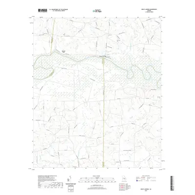
2020 Map of Grays Landing
USGS Topo · Published 2020About this map
The Altamaha River winds through this riverine landscape at the junction of Toombs, Montgomery, Jeff Davis, and Appling counties. The settlement at Grays Landing sits near the river's north bank, where the terrain transitions from the water's edge to the bluffs of McNatt Falls. This area is defined by its network of creeks and wetlands, including Bullards Cr and Little Alligator Creek, which feed into the main river channel. For local history researchers, the map identifies several family-named burial grounds dispersed across the rural road network, such as Old Smyrna Cem, Moseley Cem, and Partin Cem. The concentration of sites like Grays Landing Lake and numerous forest access roads like Check Station Rd reflects a region deeply connected to the Altamaha's natural resources and floodplain geography.
Find a feature on this map
79 named features on this map. Tap any name to fly to it.
Don’t see what you’re looking for? This feature index may not catch every label — zoom into the map to look around manually.
Map Details
Editions of this 2020 Grays Landing Map
This is the sole edition of this map. No revisions or reprints were ever made.
Other maps of this area

1953 · Waycross
USGS Topo · 1:250,000

1957 · Macon
USGS Topo · 1:250,000

1958 · Macon
USGS Topo · 1:250,000

1958 · Waycross
USGS Topo · 1:250,000

1964 · Macon
USGS Topo · 1:250,000

1970 · Johnson Corner
USGS Topo · 1:24,000

1970 · Alston
USGS Topo · 1:24,000

1970 · Uvalda
USGS Topo · 1:24,000

1970 · Baxley NE
USGS Topo · 1:24,000

1970 · Pine Grove
USGS Topo · 1:24,000