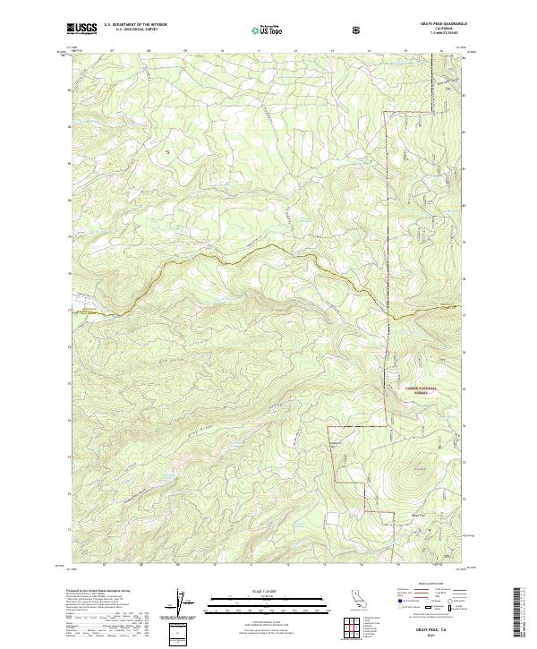
2021 Map of Grays Peak
USGS Topo · Published 2021About this map
Lassen National Forest defines the eastern landscape of this high-elevation region, where the county line between Shasta and Tehama counties crosses complex hydrologic networks. The terrain is marked by significant drainages such as S Fork Digger Cr and Onion Cr, flowing through a series of canyons and gulches including Blue Lake Canyon and Dry Gulch. Historical land use is suggested by the presence of Forwards Mill Rd, a route hinting at the area's timber history, alongside names like Sugarpine Flat and Hazen Flat. High points such as Grays Peak and the prominent Blue Ridge divide the numerous springs and creeks, including Ward Springs and Sugarpine Spring, providing a detailed look at the watershed before it descends toward the Central Valley.
Find a feature on this map
41 named features on this map. Tap any name to fly to it.
Don’t see what you’re looking for? This feature index may not catch every label — zoom into the map to look around manually.
Map Details
Editions of this 2021 Grays Peak Map
This is the sole edition of this map. No revisions or reprints were ever made.
Other maps of this area

1886 · Lassen Peak
USGS Topo · 1:250,000

1892 · Lassen Peak
USGS Topo · 1:250,000

1894 · Lassen Peak
USGS Topo · 1:250,000

1935 · Burney
USGS Topo · 1:96,000

1935 · Paynes Creek
USGS Topo · 1:96,000

1939 · Burney
USGS Topo · 1:125,000

1941 · Mineral
USGS Topo · 1:125,000

1955 · Westwood
USGS Topo · 1:250,000

1956 · Lassen Peak
USGS Topo · 1:62,500

1956 · Manton
USGS Topo · 1:62,500