
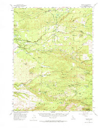
1956 Map of Manton
USGS Topo · Published 1958About this map
Manton and Shingletown anchor this mid-century survey of the volcanic foothills where Shasta and Tehama counties meet. The landscape is defined by its water resources and hydroelectric infrastructure, featuring the Volta Powerhouse, Inskip Powerhouse, and South Powerhouse along the various forks of Battle Creek. Genealogists and local historians can trace numerous family-named landmarks and homesteads, including the Childs Ranch, Shults Ranch, Wilson Ranch, and the Meyers Place.
Find a feature on this map
113 named features on this map. Tap any name to fly to it.
Don’t see what you’re looking for? This feature index may not catch every label — zoom into the map to look around manually.
Map Details
Editions of this 1956 Manton Map
2 editions found
Other maps of this area

1886 · Lassen Peak
USGS Topo · 1:250,000

1890 · Red Bluff
USGS Topo · 1:250,000

1892 · Lassen Peak
USGS Topo · 1:250,000

1894 · Lassen Peak
USGS Topo · 1:250,000

1894 · Red Bluff
USGS Topo · 1:250,000

1901 · Redding
USGS Topo · 1:125,000

1905 · Tehama
USGS Topo · 1:62,500

1935 · Burney
USGS Topo · 1:96,000

1935 · Paynes Creek
USGS Topo · 1:96,000

1939 · Burney
USGS Topo · 1:125,000