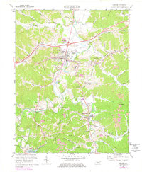
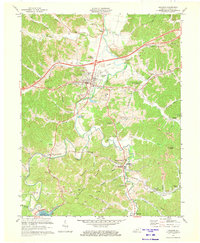
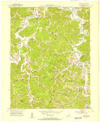
1971 Map of Grayson
USGS Topo · Published 1978About this map
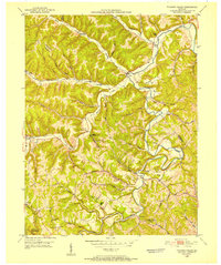
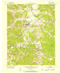
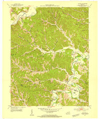
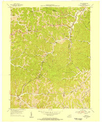
The Little Sandy River winds through the heart of Carter County, shaping a landscape defined by traditional Appalachian valley settlements and mid-century industrial development. In Grayson, the campus of Kentucky Christian College stands near the town center, while a network of pipelines and strip mines across the ridges indicates the regional reliance on energy extraction. The southern portion of the map is dominated by the massive Grayson Dam and the northern reaches of Grayson Lake, a significant alteration to the local hydrology from the original riverbed.
Find a feature on this map
77 named features on this map. Tap any name to fly to it.
Don’t see what you’re looking for? This feature index may not catch every label — zoom into the map to look around manually.
Map Details
Editions of this 1971 Grayson Map
2 editions found
Other maps of this area

1903 · Kenova
USGS Topo · 1:125,000

1904 · Kenova
USGS Topo · 1:125,000
1950 · Bruin
USGS Topo · 1:24,000
1950 · Grahn
USGS Topo · 1:24,000
1950 · Tygarts Valley
USGS Topo · 1:24,000
1953 · Grayson
USGS Topo · 1:24,000
1953 · Oldtown
USGS Topo · 1:24,000
1953 · Rush
USGS Topo · 1:24,000
1953 · Argillite
USGS Topo · 1:24,000
1953 · Webbville
USGS Topo · 1:24,000