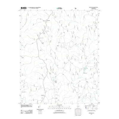
2011 Map of Grayson
USGS Topo · Published 2011About this map
Grayson and the small settlement of Ellaville occupy a landscape defined by the deep incisions of Collier Creek Canyon and Lloyds Canyon. This 2011 survey reveals a complex network of forest roads and creeks, such as Borden Creek and Brushy Creek, which carve through the high ridges of McDougal Ridge. The map is particularly significant for genealogists, as it meticulously identifies numerous family burial grounds including Tapsville Cemetery, McLemore Cemetery, and Cheatham Cemetery. The presence of the Central Lookout Tower and the Hurricane Creek Shooting Range highlights the area's modern land use for forestry and recreation. The hydrology is dominated by the Sipsey Fork and man-made features like Grayson Lake and Brushy Creek Lake, which are held by dams recorded in the survey.
Find a feature on this map
43 named features on this map. Tap any name to fly to it.
Don’t see what you’re looking for? This feature index may not catch every label — zoom into the map to look around manually.
Map Details
Editions of this 2011 Grayson Map
This is the sole edition of this map. No revisions or reprints were ever made.
Other maps of this area

1935 · Moulton
USGS Topo · 1:24,000

1935 · Upshaw
USGS Topo · 1:24,000

1935 · Danville
USGS Topo · 1:48,000

1935 · Oakville
USGS Topo · 1:24,000

1936 · Moulton
USGS Topo · 1:48,000

1936 · Landersville
USGS Topo · 1:24,000

1938 · Danville
USGS Topo · 1:62,500

1940 · Mt Hope
USGS Topo · 1:62,500

1956 · Gadsden
USGS Topo · 1:250,000

1958 · Gadsden
USGS Topo · 1:250,000