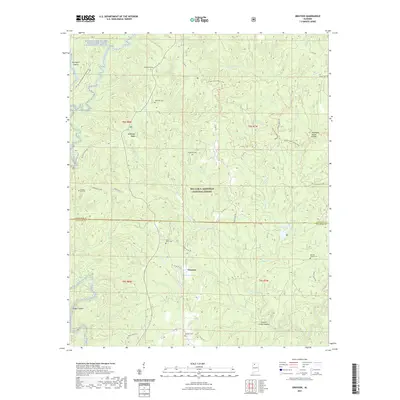
2021 Map of Grayson
USGS Topo · Published 2021About this map
William B. Bankhead National Forest encompasses the vast majority of this landscape, where the deep drainage of the Sipsey Fork of the West Fork Wild and Scenic River defines the northwestern corner. The settlement of Grayson sits near the center, positioned south of the Tennessee Valley Divide and adjacent to Grayson Lake. The map reveals a dense network of forest roads and specialized trails, including the Pine Torch Horse Loop and the Lookout Wild Hiking Trail, which navigate the complex system of ridges and hollows like McDougal Ridge and Collier Creek Canyon. Genealogy researchers will find numerous rural burial grounds preserved within the forest boundaries, such as Shiloh Cem, Tapsville Cem, and Mount Olive Cem. These sites, along with the distinct drainage patterns of Brushy Creek and W Fork Beech Cr, highlight the remote character of this region along the Winston and Lawrence County line.
Find a feature on this map
47 named features on this map. Tap any name to fly to it.
Don’t see what you’re looking for? This feature index may not catch every label — zoom into the map to look around manually.
Map Details
Editions of this 2021 Grayson Map
This is the sole edition of this map. No revisions or reprints were ever made.
Other maps of this area

1935 · Moulton
USGS Topo · 1:24,000

1935 · Upshaw
USGS Topo · 1:24,000

1935 · Danville
USGS Topo · 1:48,000

1935 · Oakville
USGS Topo · 1:24,000

1936 · Moulton
USGS Topo · 1:48,000

1936 · Landersville
USGS Topo · 1:24,000

1938 · Danville
USGS Topo · 1:62,500

1940 · Mt Hope
USGS Topo · 1:62,500

1956 · Gadsden
USGS Topo · 1:250,000

1958 · Gadsden
USGS Topo · 1:250,000