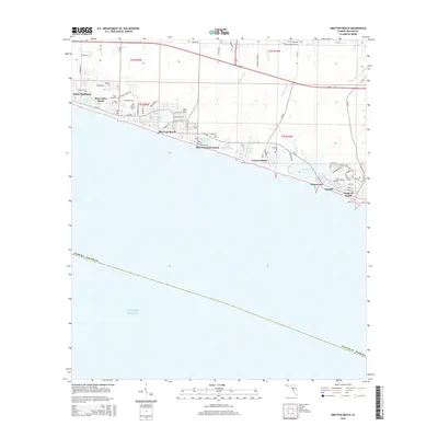
2015 Map of Grayton Beach
USGS Topo · Published 2015About this map
Coastal dune lakes and planned resort communities define this stretch of the Florida Panhandle during the early 21st century. The map documents the intricate development patterns of Beach Highlands, Dune Allen Beach, and the iconic urban design of Seaside and Watercolor. These settlements are interspersed with rare geographical features like Western Lake, Big Redfish Lake, and Oyster Lake, which sit just behind the primary dunes.
Find a feature on this map
71 named features on this map. Tap any name to fly to it.
Don’t see what you’re looking for? This feature index may not catch every label — zoom into the map to look around manually.
Map Details
Editions of this 2015 Grayton Beach Map
This is the sole edition of this map. No revisions or reprints were ever made.
Other maps of this area

1935 · Villa Tasso
USGS Topo · 1:48,000

1936 · Point Washington
USGS Topo · 1:48,000

1938 · Villa Tasso
USGS Topo · 1:62,500

1939 · Point Washington
USGS Topo · 1:62,500

1956 · Villa Tasso
USGS Topo · 1:62,500

1957 · Pensacola
USGS Topo · 1:250,000

1959 · Pensacola
USGS Topo · 1:250,000

1960 · Pensacola
USGS Topo · 1:250,000
1970 · Bunker
USGS Topo · 1:24,000
1970 · Miramar Beach
USGS Topo · 1:24,000