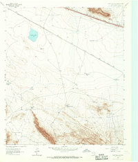
1963 Map of Grayton Lake
USGS Topo · Published 1967About this map
The Old Spanish Trail cuts through this arid Hudspeth County landscape, reflecting the long-established transit corridors that defined West Texas. This 1963 survey captures a region where survival is dictated by the availability of water, evidenced by a dense network of catchment features like the Triple Tanks, Mc Adoo Tank, and the ironically named Malo Suerte Tank. These water sources support isolated outposts like the Isbell Ranch and the curious Streetcar Camp, tucked near the rugged elevation of the Love Hogback.
Find a feature on this map
26 named features on this map. Tap any name to fly to it.
Don’t see what you’re looking for? This feature index may not catch every label — zoom into the map to look around manually.
Map Details
Editions of this 1963 Grayton Lake Map
This is the sole edition of this map. No revisions or reprints were ever made.
Other maps of this area

1895 · Sierra Blanca
USGS Topo · 1:125,000

1897 · Eagle Mountain
USGS Topo · 1:125,000

1916 · Eagle Mountain
USGS Topo · 1:125,000

1954 · Van Horn
USGS Topo · 1:250,000

1958 · Van Horn
USGS Topo · 1:250,000

1959 · Marfa
USGS Topo · 1:250,000

1964 · Devil Ridge
USGS Topo · 1:24,000
1964 · Allamoore
USGS Topo · 1:24,000

1964 · Dome Peak
USGS Topo · 1:24,000
1964 · Bean Hills
USGS Topo · 1:24,000