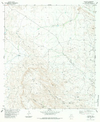
1983 Map of Graytop
USGS Topo · Published 1984About this map
Nine Point Mesa dominates this West Texas landscape, its high plateau flanked by the Black Hills to the east and the landmark summit of Graytop. This 1980s-era topographic study shows a vast grazing environment where water management is the primary human footprint, marked by scattered springs, tanks, and wells. The Nine Point Mesa Ranch sits at the heart of this network, connected by a network of unimproved roads and a Jeep Trail that cuts through the arid terrain.
Find a feature on this map
29 named features on this map. Tap any name to fly to it.
Don’t see what you’re looking for? This feature index may not catch every label — zoom into the map to look around manually.
Map Details
Editions of this 1983 Graytop Map
2 editions found
Other maps of this area

1917 · Agua Fria
USGS Topo · 1:62,500

1917 · Santiago Peak
USGS Topo · 1:62,500

1917 · Buck Hill
USGS Topo · 1:62,500

1918 · Bone Spring
USGS Topo · 1:125,000

1918 · Buck Hill
USGS Topo · 1:62,500

1918 · Santiago Peak
USGS Topo · 1:62,500

1918 · Nine Point Mesa
USGS Topo · 1:62,500

1925 · Buck Hill
USGS Topo · 1:62,500

1937 · Nine Point Mesa
USGS Topo · 1:62,500

1937 · Agua Fria
USGS Topo · 1:62,500