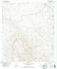
1983 Map of Graytop
USGS Topo · Published 1984About this map
Nine Point Mesa dominates the southwestern quadrant of this Brewster County landscape, its steep escarpments giving way to a network of high desert drainage systems and isolated springs. The ranching heritage of the Big Bend region is evident through the presence of the Nine Point Mesa Ranch and numerous water management features such as Tanque de Baldez and Good Luck Well. These water sources, alongside named springs like Cartwright Spring and Lease Spring, were critical for livestock in this arid environment. The map also reveals a high-altitude infrastructure including a Radio Tower near Graytop and distinct Landing Strips carved into the plateau near Cedar Creek. A major Pipeline traverses the southern terrain, intersecting with various draws such as Willow Canyon and Red Canyon Spring.
Find a feature on this map
29 named features on this map. Tap any name to fly to it.
Don’t see what you’re looking for? This feature index may not catch every label — zoom into the map to look around manually.
Map Details
Editions of this 1983 Graytop Map
2 editions found
Other maps of this area

1917 · Agua Fria
USGS Topo · 1:62,500

1917 · Santiago Peak
USGS Topo · 1:62,500

1917 · Buck Hill
USGS Topo · 1:62,500

1918 · Bone Spring
USGS Topo · 1:125,000

1918 · Buck Hill
USGS Topo · 1:62,500

1918 · Santiago Peak
USGS Topo · 1:62,500

1918 · Nine Point Mesa
USGS Topo · 1:62,500

1925 · Buck Hill
USGS Topo · 1:62,500

1937 · Nine Point Mesa
USGS Topo · 1:62,500

1937 · Agua Fria
USGS Topo · 1:62,500