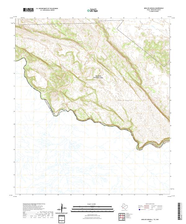
2022 Map of Mesa De Anguila
USGS Topo · Published 2022About this map
Big Bend National Park dominates this terrain, where the massive Mesa de Anguila stands as a primary topographical feature near the international border. The landscape is defined by the winding course of the Rio Grande as it cuts through the dramatic Santa Elena Canyon. This area remains largely wilderness, navigated primarily by historic paths like the Mesa De Anguila Trl and the Entrance Camp Trl, which provide access to interior points such as Tinaja Grande and the heights of Sierra Aguja. The map documents a sparsely settled borderland where water sources like Well Cr are critical landmarks in a vast high-desert environment. The lack of modern infrastructure highlights the enduring isolation of this Brewster County landscape.
Find a feature on this map
11 named features on this map. Tap any name to fly to it.
Don’t see what you’re looking for? This feature index may not catch every label — zoom into the map to look around manually.
Map Details
Editions of this 2022 Mesa De Anguila Map
This is the sole edition of this map. No revisions or reprints were ever made.
Other maps of this area

1903 · Terlingua
USGS Topo · 1:125,000

1904 · Terlingua
USGS Topo · 1:125,000

1931 · Lajitas
USGS Topo · 1:62,500

1959 · Emory Peak
USGS Topo · 1:250,000

1965 · Emory Peak
USGS Topo · 1:250,000

1971 · Terlingua
USGS Topo · 1:24,000

1971 · Amarilla Mountain
USGS Topo · 1:24,000
1971 · Castolon
USGS Topo · 1:24,000
1971 · Lajitas
USGS Topo · 1:24,000
1971 · Mesa De Anguila
USGS Topo · 1:24,000