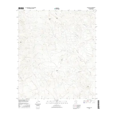
2016 Map of Yellow Hill
USGS Topo · Published 2016About this map
Lefthand Shutup and Black Ridge define the stark, high-elevation topography of this Brewster County landscape. This 2016 survey by the U.S. Geological Survey details a region defined by dramatic vertical relief and intermittent drainage systems, such as Saltgrass Draw, which feed into Terlingua Cr in the northeast. The geography is marked by isolated summits and ranges, including Yellow Hill, the Blue Range, and Pinks Peak. Access across this desert terrain is limited to a sparse network of unpaved routes like Hen Egg Rd and Herman's Peak Rd, reflecting a landscape where movement is strictly dictated by the natural breaks in the mountain ranges. The mapping of these drainages and peaks provides essential context for understanding the hydrology and land use in this part of the Trans-Pecos region.
Find a feature on this map
11 named features on this map. Tap any name to fly to it.
Don’t see what you’re looking for? This feature index may not catch every label — zoom into the map to look around manually.
Map Details
Editions of this 2016 Yellow Hill Map
This is the sole edition of this map. No revisions or reprints were ever made.
Other maps of this area

1903 · Terlingua
USGS Topo · 1:125,000

1904 · Terlingua
USGS Topo · 1:125,000

1917 · Agua Fria
USGS Topo · 1:62,500

1917 · Tascotal Mesa
USGS Topo · 1:62,500

1931 · Lajitas
USGS Topo · 1:62,500

1937 · Agua Fria
USGS Topo · 1:62,500

1944 · Tascotal Mesa
USGS Topo · 1:62,500

1959 · Emory Peak
USGS Topo · 1:250,000

1965 · Emory Peak
USGS Topo · 1:250,000

1971 · Yellow Hill
USGS Topo · 1:24,000